Along the Lubina River
TYPE: walking trip, walking trip - suitable with a baby stroller, bicycle trip, roller blades trip

STARTING POINT
Příbor, railway station
Transport to the starting point:
-
train, bus (Příbor, railway station)
-
car (near the train station in Příbor, Větřkovská Street, or Orinoko Refreshment stand in a cottage settlement, which is suitable for inline skaters)

FINISHING POINT
Orinoko Refreshment
ROUTE
STARTING POINT: Příbor, railway station (0 km) – (A) Orinoko Refreshment – FINISHING POINT: Tempo Vlčovice Restaurant (6,7 km)
easy
 6,7 km
 44 m
44 m
 0 m
0 m
VIEW ON
FOR DOWNLOADING
POINTS OF INTEREST ON THE ROUTE
DESCRIPTION OF THE ROUTE
The route starts at the train station (but can be started at Orinoko Refreshment Stand). Follow the trail marking ![]() along the bridge over Lubina River and then right along Větřkovská Street. From there, the common pedestrian and cycling trail will be separated after approximately 600 meters and continue along it. After approximately 700 meters near a wooden shed, the route connects to the local road, which is approximately 150 meters in the very narrow following section. Pay attention to personal safety, you could encounter a vehicle! When green continues straight between the garden houses, go right along the PG01
along the bridge over Lubina River and then right along Větřkovská Street. From there, the common pedestrian and cycling trail will be separated after approximately 600 meters and continue along it. After approximately 700 meters near a wooden shed, the route connects to the local road, which is approximately 150 meters in the very narrow following section. Pay attention to personal safety, you could encounter a vehicle! When green continues straight between the garden houses, go right along the PG01 ![]() - Radhošť Trail (trail marking with the Radegast symbol).The Orinoko refreshment stand is on the left after 100 meters. A short walking and cycling trail is just a short walk away. Follow it all the way to the bridge over the Lubina River, turn right across the bridge and behind the bridge turn left along the local roads (follow the signs to Kopřivnice). The traffic is moderate there, but of course you can encounter a car, and in some places the road is narrower. When you arrive at the cycling signpost, which will be in the direction of Kopřivnice and Hukvaldy, go straight ahead. A few meters away is another intersection, a crossing with the main road across the Lubina. Turn right (sign Vlčovice), in 100 meters the route goes along the sidewalk around this road, then turn left onto the local road (directional sign Vlčovice). After approximately 600 meters, a common hiking and cycling trail begins. Follow it to the built-up area of Vlčovice. In Vlčovice by house No. 37, the street divides into a fork, go left to the junction at the bridge over the Lubina River. Cross the path and behind it a common path for pedestrians and cyclists begins. This changes into a local road after 170 meters. At the next intersection, turn left onto the I / 58 road. In front of you is the Tempo restaurant where the route ends and where you can refresh yourself. You can return to the starting point along the same route (for inline skaters), you can take the bus (the stop is about 200 meters to the right of the restaurant - in front of it, or you can go back to the bridge over the Lubina River and turn right onto the bridge and after 500 meters at the bus stop you will come across a tourist signpost. You can get back to the starting point by going up the hill following the
- Radhošť Trail (trail marking with the Radegast symbol).The Orinoko refreshment stand is on the left after 100 meters. A short walking and cycling trail is just a short walk away. Follow it all the way to the bridge over the Lubina River, turn right across the bridge and behind the bridge turn left along the local roads (follow the signs to Kopřivnice). The traffic is moderate there, but of course you can encounter a car, and in some places the road is narrower. When you arrive at the cycling signpost, which will be in the direction of Kopřivnice and Hukvaldy, go straight ahead. A few meters away is another intersection, a crossing with the main road across the Lubina. Turn right (sign Vlčovice), in 100 meters the route goes along the sidewalk around this road, then turn left onto the local road (directional sign Vlčovice). After approximately 600 meters, a common hiking and cycling trail begins. Follow it to the built-up area of Vlčovice. In Vlčovice by house No. 37, the street divides into a fork, go left to the junction at the bridge over the Lubina River. Cross the path and behind it a common path for pedestrians and cyclists begins. This changes into a local road after 170 meters. At the next intersection, turn left onto the I / 58 road. In front of you is the Tempo restaurant where the route ends and where you can refresh yourself. You can return to the starting point along the same route (for inline skaters), you can take the bus (the stop is about 200 meters to the right of the restaurant - in front of it, or you can go back to the bridge over the Lubina River and turn right onto the bridge and after 500 meters at the bus stop you will come across a tourist signpost. You can get back to the starting point by going up the hill following the ![]() trail marking (about 7.7 km).
trail marking (about 7.7 km).
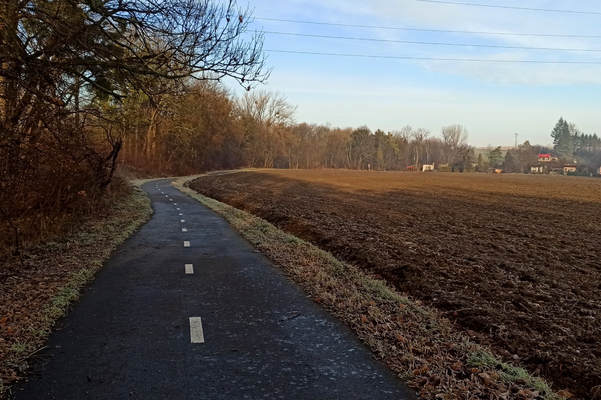
TOP point of interest along the route: Cycle path „From Poodří to Beskydy“ - suitable for inline skating